Local landscapes
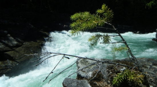
The Quesnel River Research Centre is located on the Quesnel River in the foothills of the Cariboo Mountains. It is surrounded by lakes, rivers, and streams that act as linkages to the various landscapes in the area. A wide variety of habitats from range lands to glaciated mountain peaks and alpine meadows, to old growth interior temperate rainforest are located within a short drive of the research centre.
Natural Landscape Features:
- Quesnel Lake is 104 km long and offers more than 500 kilometres of shoreline
- Quesnel, Cariboo, Mitchell, and Horsefly rivers
- A multitude of small lakes and streams
- A variety of bio-geoclimatic zones within the area
- The 6,060 hectare Cariboo River Protected Area
- Anadromous salmonids such as chinook, coho, sockeye, and pink salmon
- Non anadromous fish such as rainbow trout, bull trout, dolly varden and kokanee
- Other fish species such as burbot, mountain whitefish, northern pikeminnow, longnose dace, peamouth chub, redside shiner, suckers
- The Cariboo Mountains and its varied wildlife including grizzly and black bear, wolverine, cougar, lynx, caribou, elk, moose, deer, mountain
Land-uses and Industrial Activities:
- Historical large scale hydraulic placer mining such as the world famous Bullion Pit Mine
- Current open pit and placer mining
- Active forest harvesting and management by major licencees
- A community forest joint venture between Xat'sull First Nation and the community of Likely
- Nearby research forest - UBC Alex Fraser Research Forest
- Other landuses including: cattle ranching, woodlots and market farms
Cultural and Recreation Interests:
- Quesnel Forks heritage attraction was the largest town north of San Francisco in 1859
- Historical and current First Nations presence
- Historical Chinese presence since 1859 including the first Tong House in BC
- Sport fishing, rafting and kayaking
- Backcountry hiking, heliskiing and snowmobiling
- The Likely museum located in Cedar Point Park


