Climate Change and BC's Glaciers
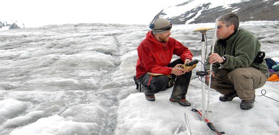
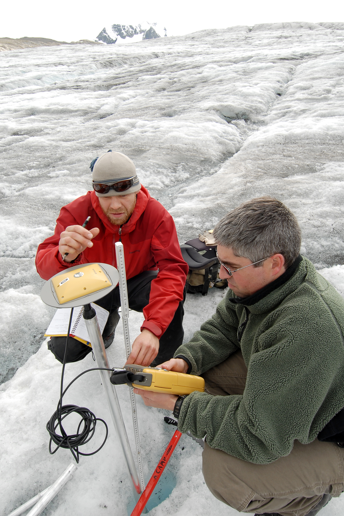
PhD student Matt Beedle (left) and professor Brian Menounos measure changes in glacier thickness using GPS. Download high-resolution image.
Melting, Melting, Melting
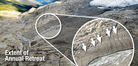
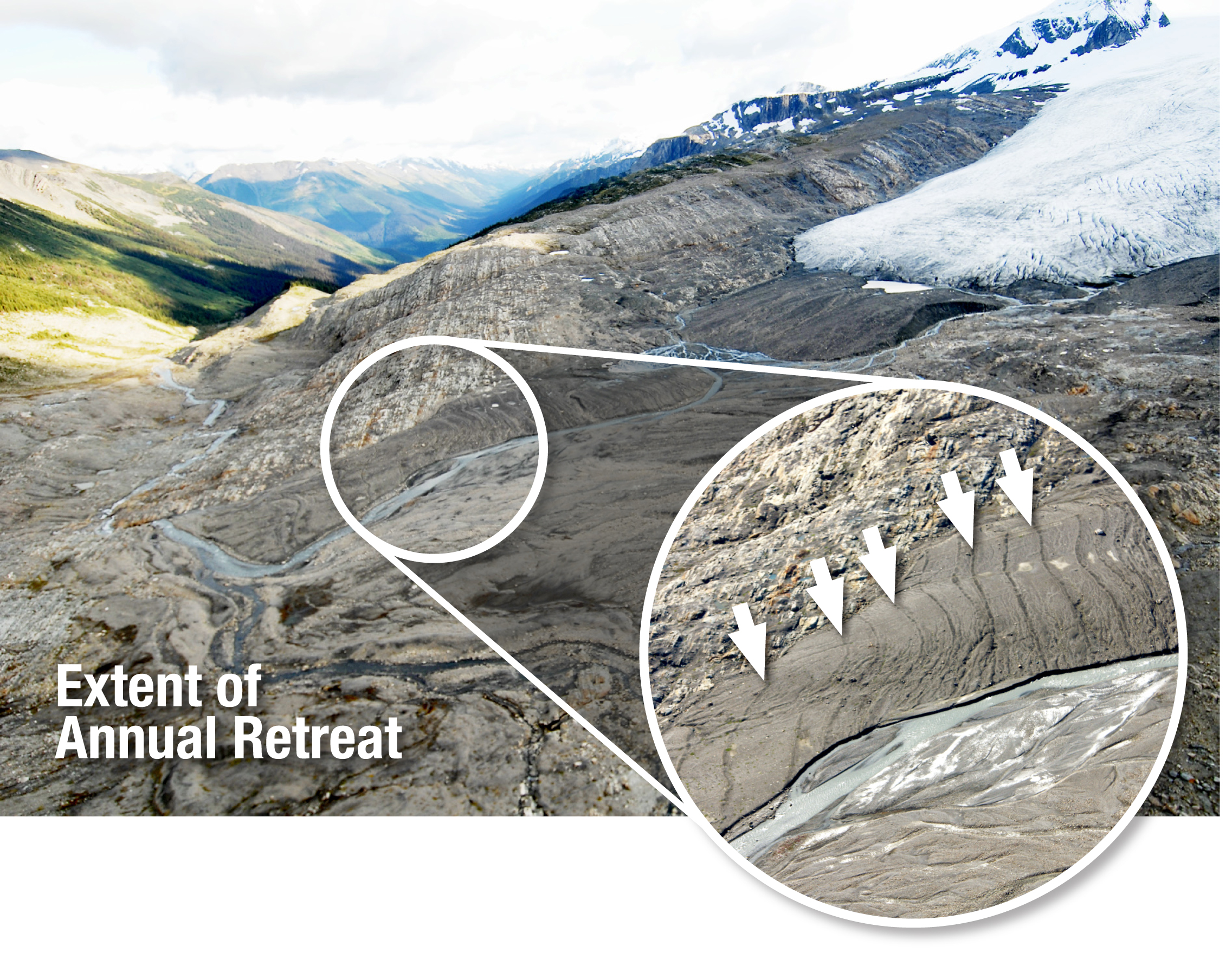
The Castle Creek Glacier is unique outside of Iceland, leaving behind a record of annual retreat that resembles tree rings.
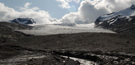
Castle Creek Glacier. Download high-resolution image.
Around the world, glaciers are melting, but what about glaciers in western Canada? A comprehensive study of the current state and future fate of glaciers in BC and Alberta is currently underway, and the early results are disturbing.
Imagine filling up BC Place Stadium with water. Then empty it. Now repeat the process 8300 times. This would require 22 billion cubic metres of water, the same amount that BC’s 17,000 glaciers are permanently losing EACH YEAR.
“Glaciers are sensitive indicators of climate, but they are also among western Canada’s most important freshwater resources. This project is allowing us to calculate the number, and total area, of glaciers in BC and Alberta. Even more importantly, we are able to assess – for the first time – how quickly these glaciers are melting in the current climate,” says Dr. Brian Menounos, a UNBC Geography professor who is leading the research program. Researchers from Universities in Alberta, BC, Washington State, in addition to scientists from the federal government are part of the study, which aims to document recent glacier retreat and the current health of glaciers to be able to predict what their fate will be up to 150 years from now.
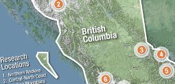
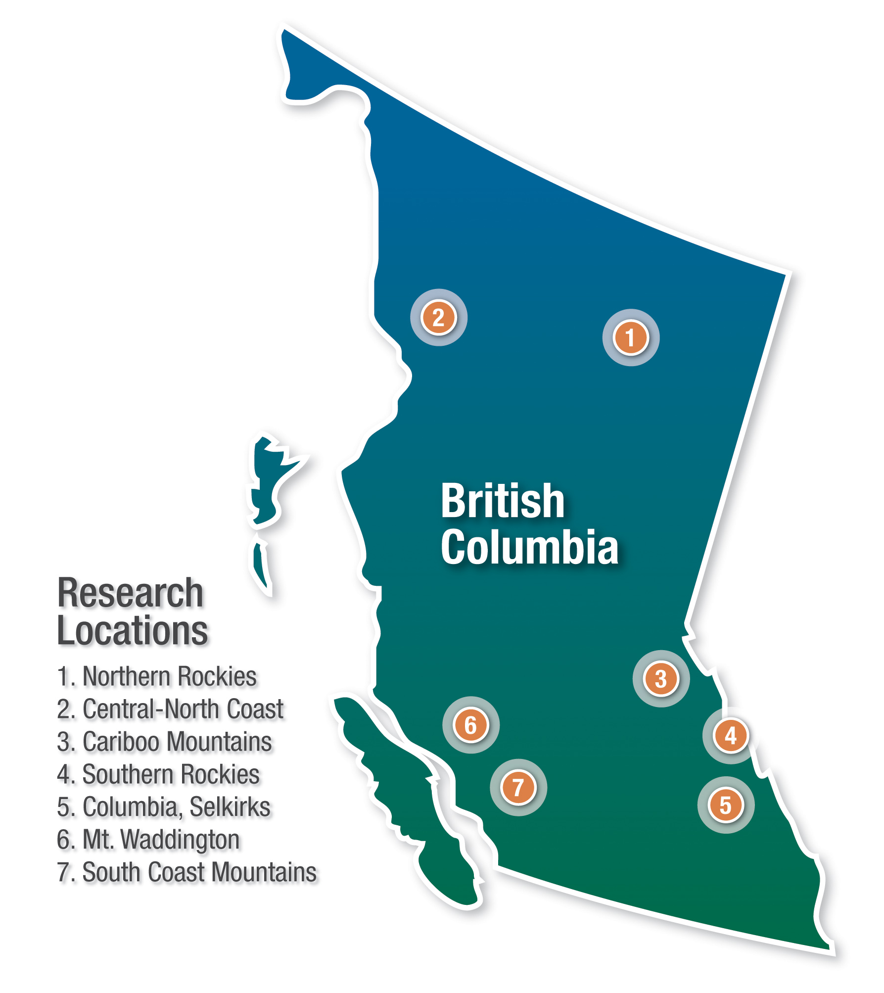
Map of research locations with terrain (from Google).
Download high-resolution image.
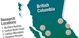
Map of research locations without terrain.
Download high-resolution image.
The research team is focusing their efforts on several glaciers and icefields in BC. The list includes the Lloyd George Icefield west of Fort Nelson, Castle Creek Glacier near McBride, Klinaklini and Tiedemann glaciers in the Coast Mountains, and glaciers in the Columbia River Basin. At each site, meteorological measurements such as air temperature, wind speed, precipitation, and humidity are being taken to better understand the controls of glacier nourishment and melt. The researchers are also measuring changes in thickness, extent, volume, and movement of hundreds of glaciers throughout the mountain ranges of western Canada. This work requires the analysis of thousands of aerial photos, some of which go back 70 years.
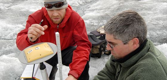
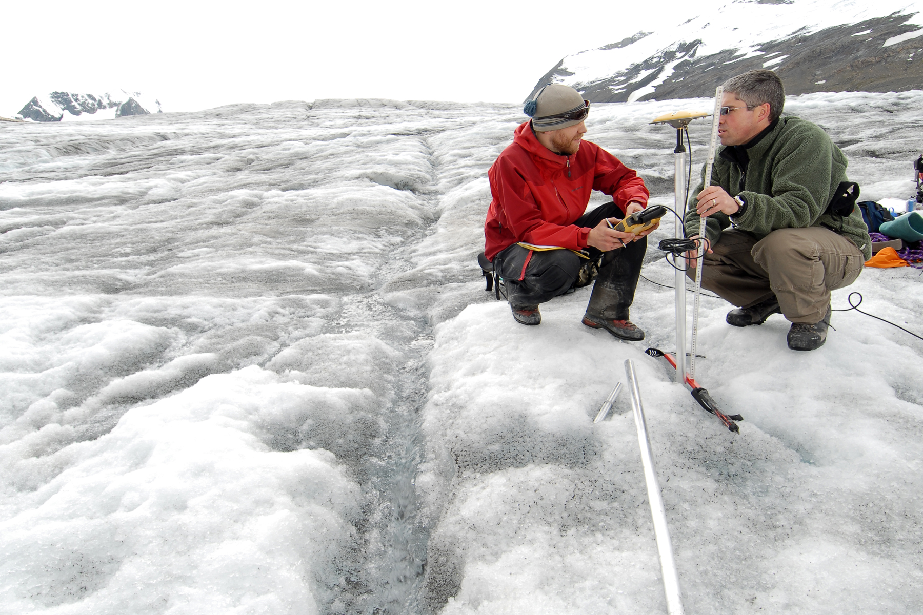
Beedle and Menounos with the GPS equipment.Download high-resolution image.
During a recent visit to Castle Creek Glacier, UNBC doctoral student Matt Beedle measured changes in the glacier’s volume through intensive field work. Just a month ago, a pole he had stuck into the glacier with only a few millimeters showing at the top was now exposed to nearly his height. Using GPS equipment that can measure his elevation on the glacier within a centimetre, Beedle was able to confirm that the thickness of the glacier at that point had dropped more than 1.5 metres through the month of August alone.
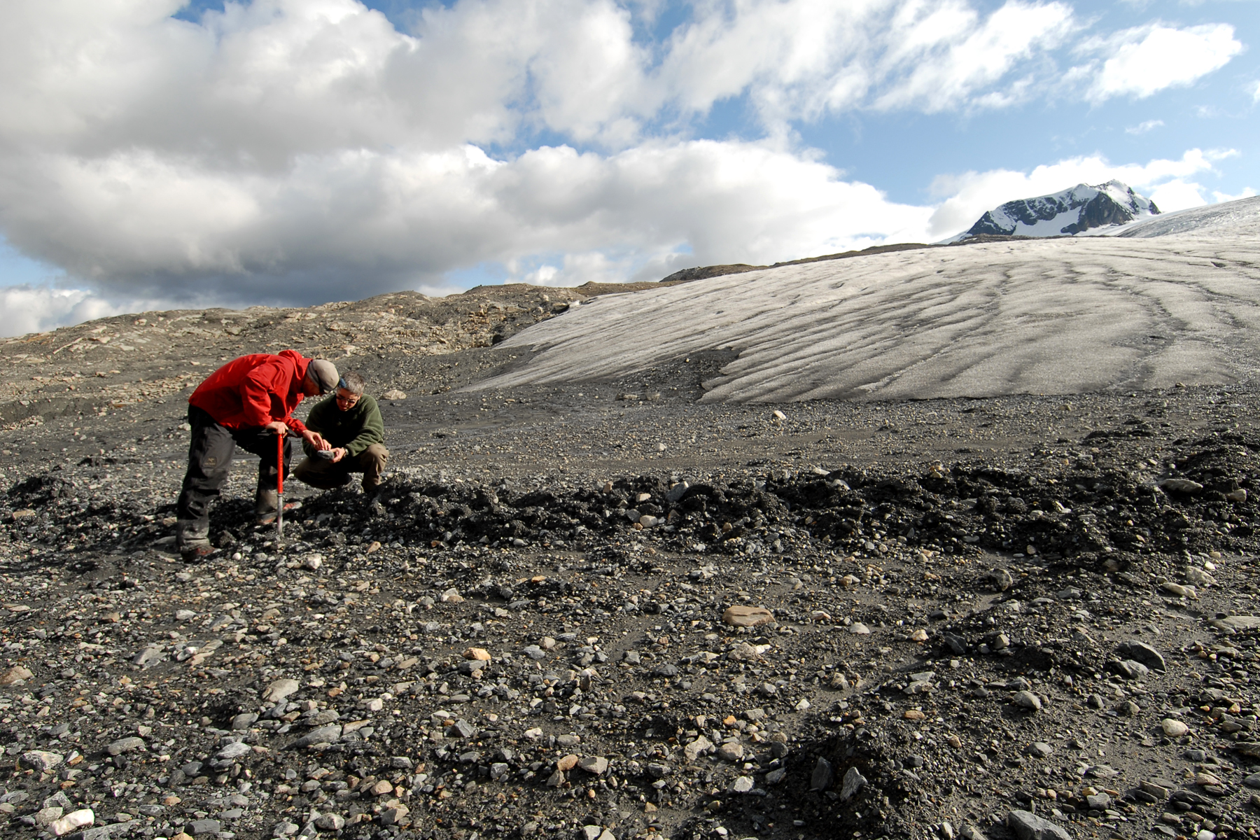
This image features a close-up of the moraines left behind by the Castle Creek Glacier as it receded.Download high-resolution image.
But the Castle Creek Glacier is a significant research site for other reasons. As it has been melting, the glacier has left a series of rows of rock and earth (called moraines) that precisely indicate how much the glacier has retreated each year. Similar to tree rings, they extend into the valley 750 metres from the glacier’s current edge, providing a unique geological record of this glacier’s retreat over the past 50 years.
“We’ve never seen moraines like this outside of Iceland,” says Beedle, who has also worked on glaciers in Alaska. “These moraines allow us to see even subtle annual variations in glacial retreat. What a global treasure.”
The research team is about half-way through the five year project. By 2010, they’ll be able to predict the rate and magnitude of glacial retreat under various climate scenarios. Their results bear directly on how we manage our water resources, access fresh water, and even produce electricity in the near future.
The research is being funded by an investment of nearly $2.2 million from the Canadian Foundation for Climate and Atmospheric Sciences and cash contributions from universities and network partners such as BC Hydro and the Columbia Basin Trust. Other participating institutions include the University of British Columbia, Simon Fraser University, University of Alberta, University of Calgary, University of Victoria, University of Washington, federal and provincial governments, Natural Resources Canada, and the Columbia Basin Trust.

Beedle and Menounos examine the moraine left behind by the Castle Creek Glacier in 2007.Download high resolution image.
Glacier Facts (2005)
- BC has about 17,000 glaciers and Alberta has around 800.
- Glaciers cover 3% of BC’s land mass.
- Between 1985 and 1999, the annual amount of water lost from melting glaciers in BC was 22 cubic kilometres.
- Close to 90% of BC’s energy is hydroelectric, and melting snow and ice play a significant role.
- The largest glacier entirely in BC is the Klinaklini Glacier, with an area of 470 square kilometres.